


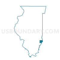
PETTY 26 Voting District, Lawrence County, Illinois
About
Outline

Summary
| Unique Area Identifier | 572544 |
| Name | PETTY 26 Voting District |
| County | Lawrence County |
| State | Illinois |
| Area (square miles) | 28.30 |
| Land Area (square miles) | 28.28 |
| Water Area (square miles) | 0.02 |
| % of Land Area | 99.92 |
| % of Water Area | 0.08 |
| Latitude of the Internal Point | 38.79750140 |
| Longtitude of the Internal Point | -87.78828710 |
Maps


Graphs
Select a template below for downloading or customizing gragh for PETTY 26 Voting District, Lawrence County, Illinois


Neighbors
Neighoring Voting District (by Name) Neighboring Voting District on the Map
- BOND 2 Voting District, Lawrence County, IL
- BOND 3 Voting District, Lawrence County, IL
- BRIDGEPORT 7 Voting District, Lawrence County, IL
- CHRISTY 8 Voting District, Lawrence County, IL
- HONEY CREEK 2 Voting District, Crawford County, IL
- LAWRENCE 15 Voting District, Lawrence County, IL
- PETTY 25 Voting District, Lawrence County, IL
- SOUTHWEST Voting District, Crawford County, IL
Top 10 Neighboring County Subdivision (by Population) Neighboring County Subdivision on the Map
- Lawrence township, Lawrence County, IL (6,521)
- Christy township, Lawrence County, IL (3,774)
- Bridgeport township, Lawrence County, IL (2,420)
- Honey Creek township, Crawford County, IL (1,563)
- Petty township, Lawrence County, IL (729)
- Bond township, Lawrence County, IL (685)
- Southwest township, Crawford County, IL (97)
Top 10 Neighboring Unified School District (by Population) Neighboring Unified School District on the Map
- Red Hill Community Unit School District 10, IL (8,629)
- Lawrence County Community Unit District 20, IL (8,313)
- Oblong Community Unit School District 4, IL (3,985)